Topographische Karte des Kantons Luzern
1864
H. Müllhaupt u. Sohn
1:25k
Topographische Karte des Kantons Luzern
1864
H. Müllhaupt u. Sohn
1:25k
Brünig-Bahn
1880
[s.n.]
1:100k
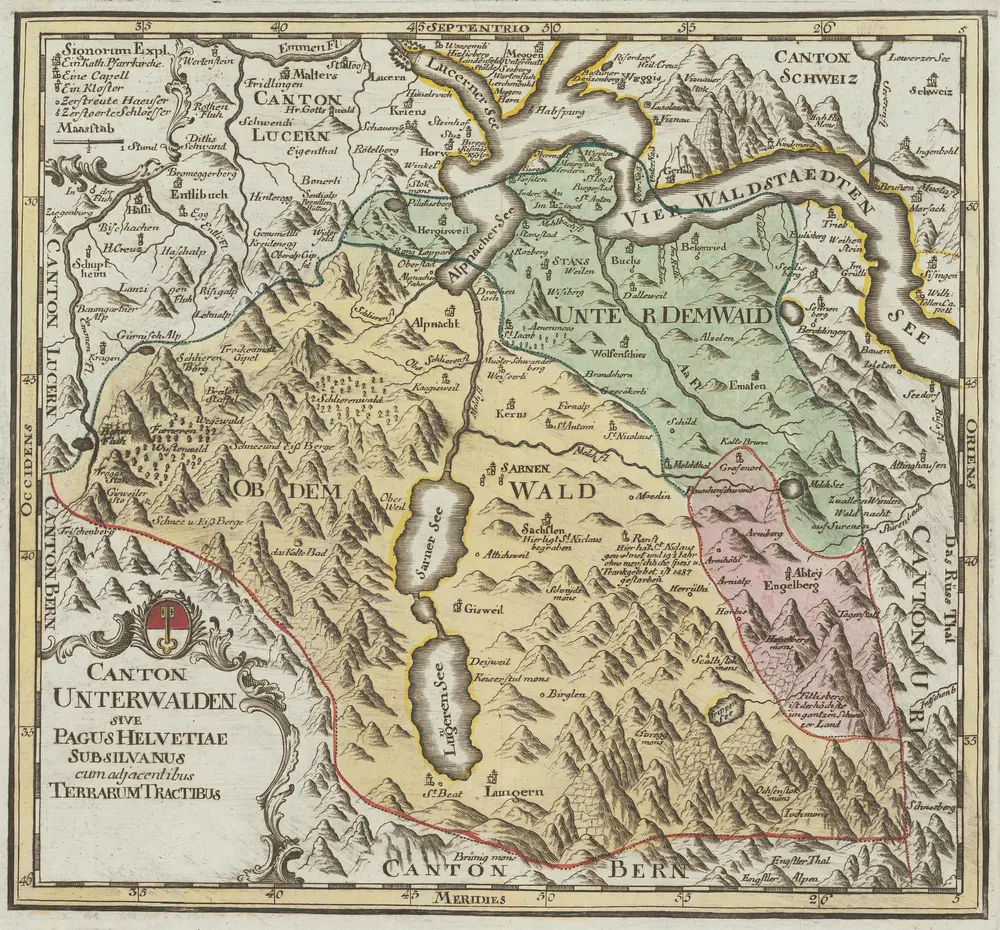
Canton Unterwalden sive Pagus Helvetiae Subsylvanus cum adjacentibus Terrarum Tractibus recenter delineatus
1767
Walser, Gabriel
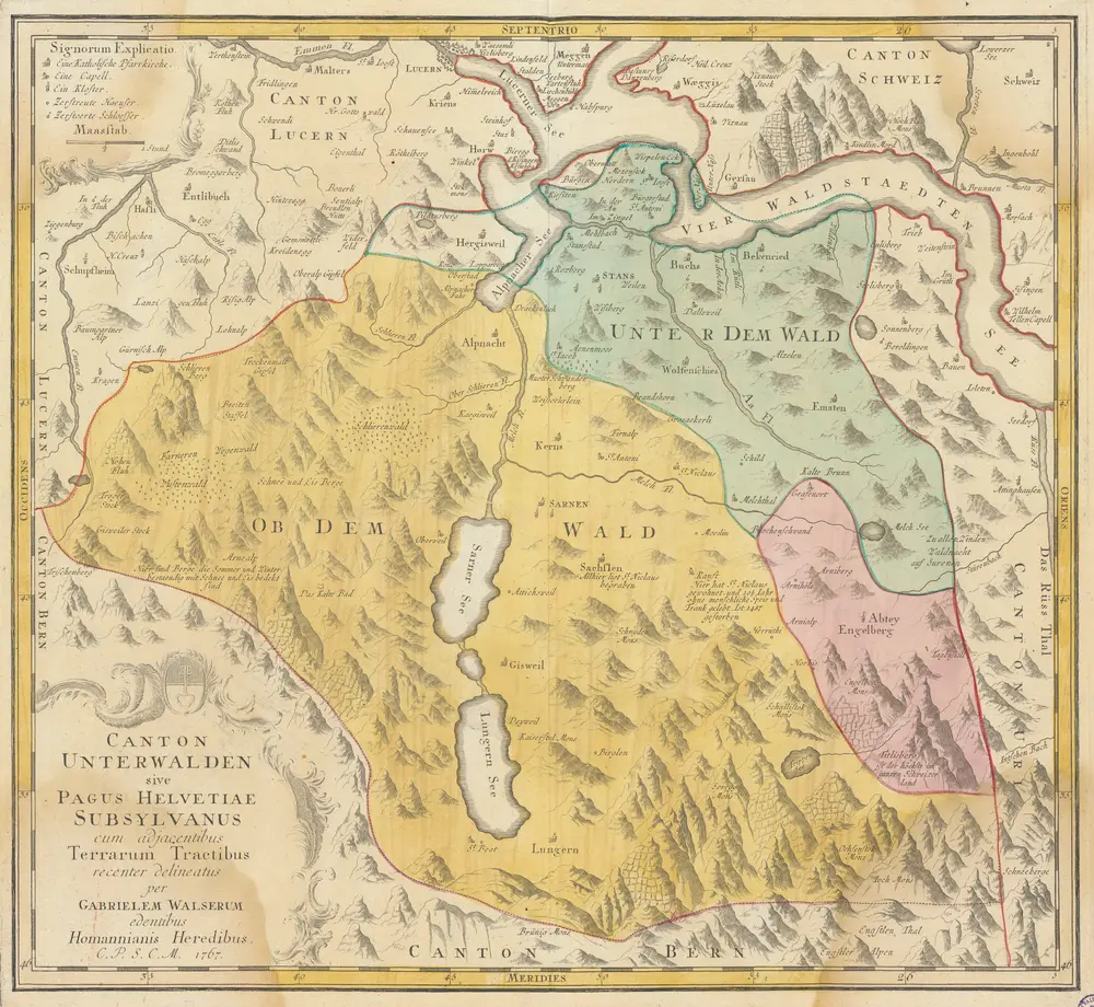
Canton Unterwalden sive Pagus Helvetiae Subsylvanus cum adjacentibus Terrarum Tractibus [...] [Karte], in: [Atlas novus Reipublicae Helveticae], S. 19.
1769
Walser, Gabriel
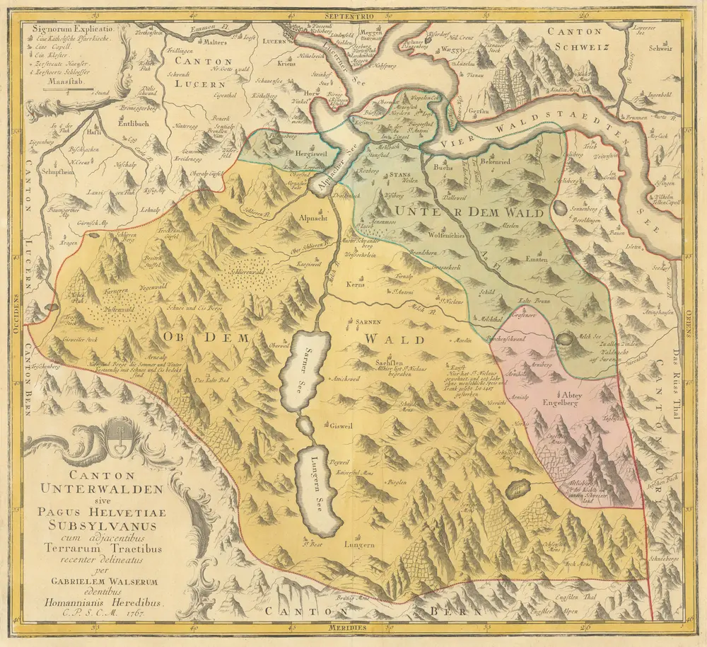
Canton Unterwalden sive Pagus Helvetiae Subsylvanus cum adjacentibus Terrarum Tractibus [...] [Karte], in: [Atlas factice], S. 129.
1767
Walser, Gabriel
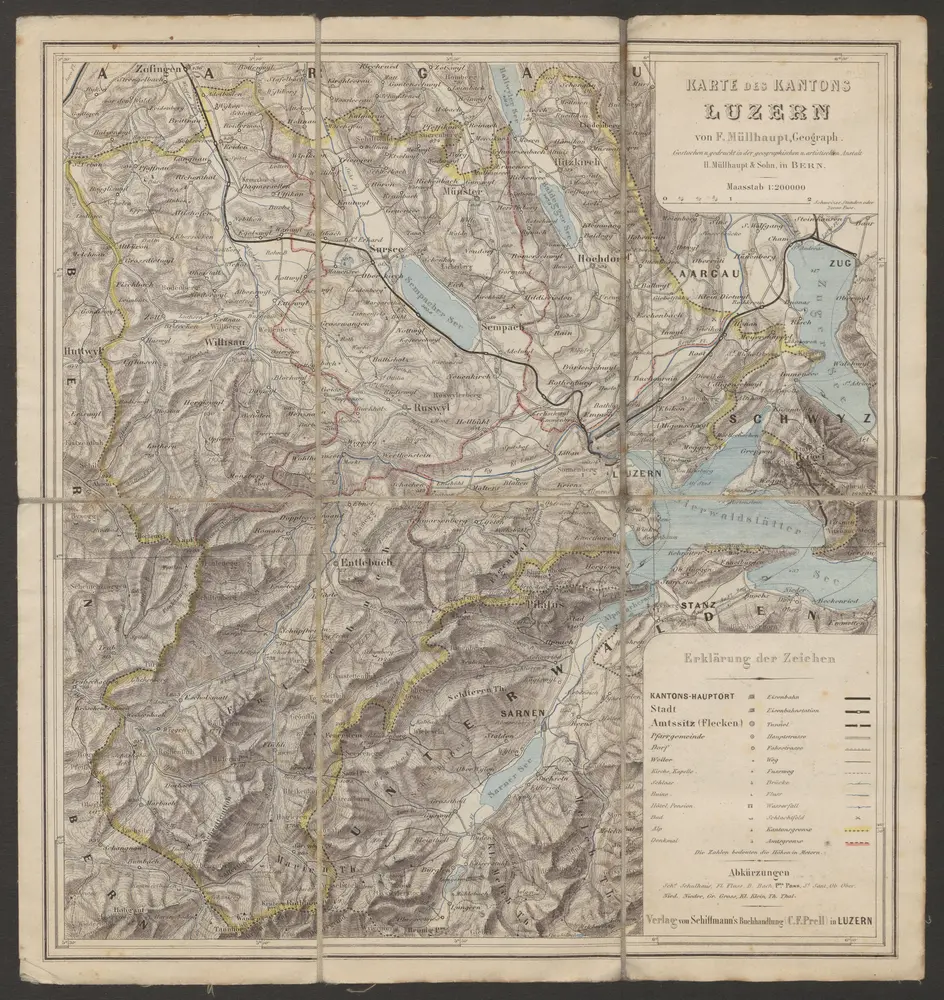
Karte des Kantons Luzern
1880
Müllhaupt, Fritz
1:200k
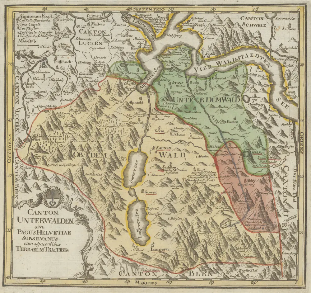
Canton Unterwalden sive Pagus Helvetiae Subsylvanus cum adjacentibus Terrarum Tractibus [...] [Karte], in: Atlas novus Reipublicae Helveticae, S. 50.
1769
Gabriel Walser
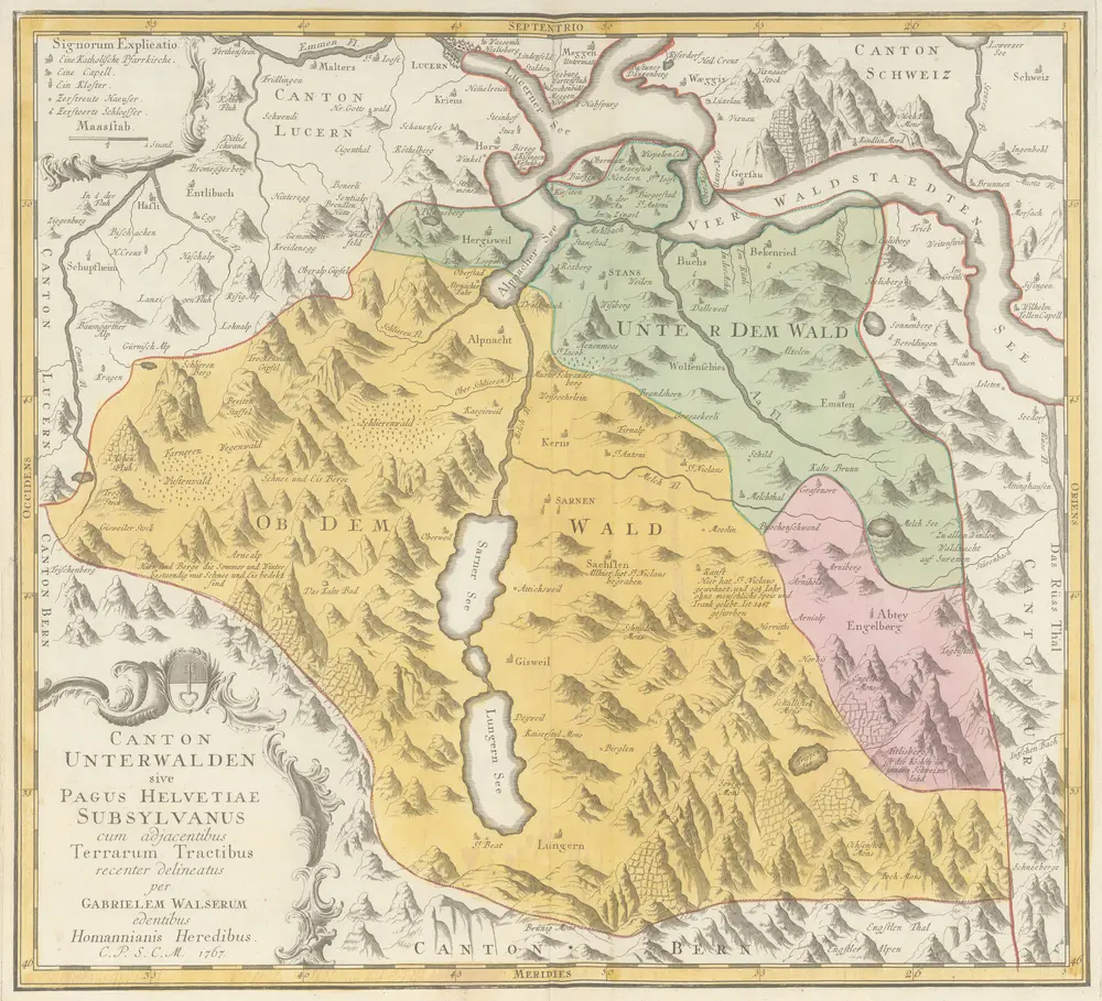
Canton Unterwalden sive Pagus Helvetiae Subsilvanus cum adjacentibus Terrarum Tractibus [Karte], in: Schweizerischer Atlas, S. 28.
1770
Gabriel Walser
Canton Unterwalden sive Pagus Helvetiae Subsilvanus cum adjacentibus Terrarum Tractibus [Karte], in: Schweizerischer Atlas, S. 7.
1770
Walser, Gabriel