

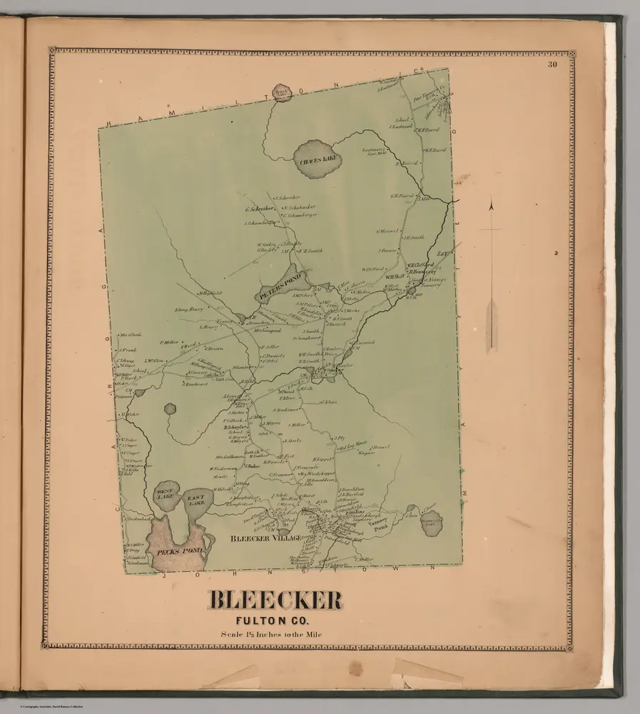
Bleecker, Fulton County, New York.
1868
Nichols, Beach
1:42k
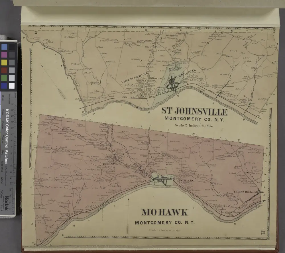
St. Johnsville Montgomery Co. [Township]; Mohawk Montgomery Co. [Township]
1868
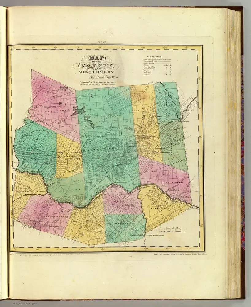
Montgomery County.
1829
Burr, David H., 1803-1875
1:151k
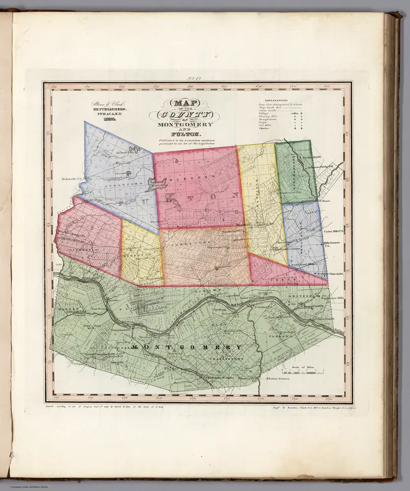
Map of the Counties of Montgomery and Fulton (New York).
1839
Burr, David H., 1803-1875
1:166k
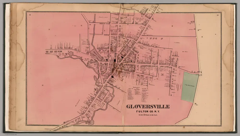
Gloversville, Fulton County, New York.
1868
Nichols, Beach
1:4k
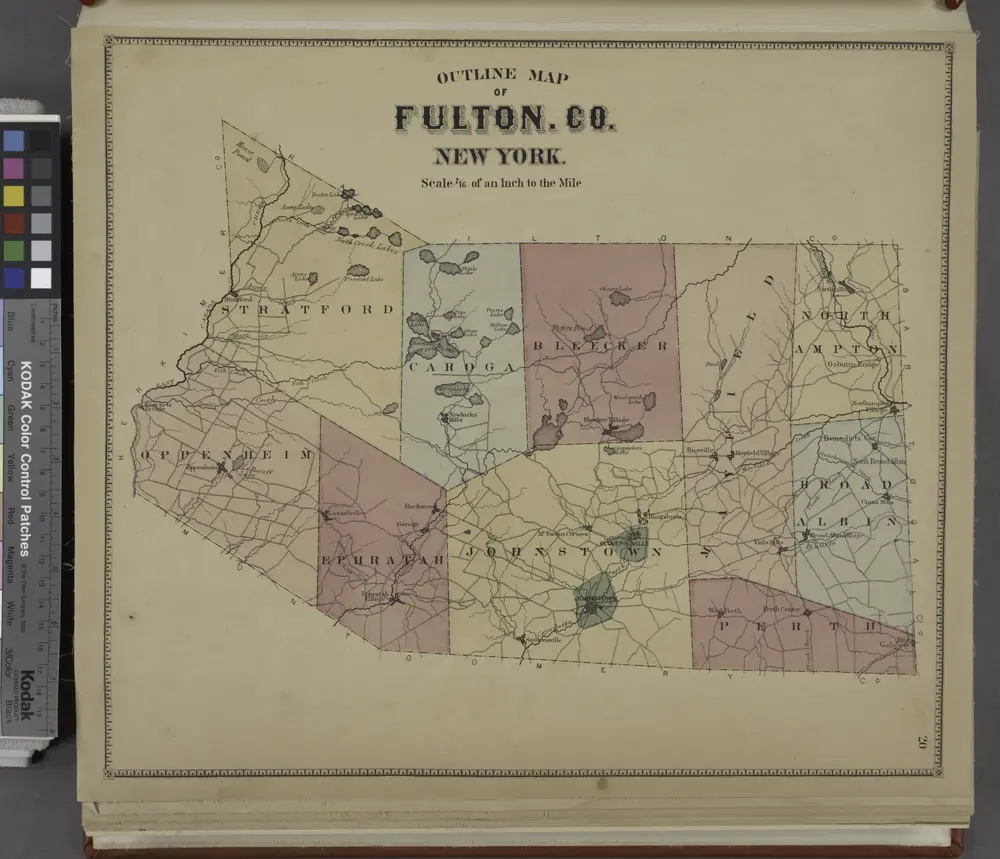
Outline Map of Fulton Co. New York.
1868

Map of the counties of Albany and Schenectady / by David H. Burr ; engd. by Rawdon, Clark & Co., Albany, & Rawdon, Wright & Co., N.Y.
1829
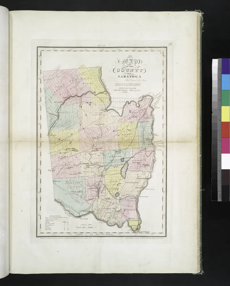
Map of the county of Saratoga / by David H. Burr ; engd. by Rawdon, Clark & Co., Albany, & Rawdon, Wright & Co., N. York.
1829
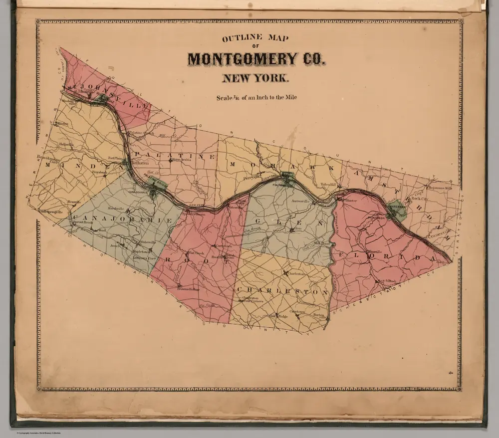
Montgomery Co. New York
1868
Nichols, Beach
1:145k

Map of the county of Saratoga / by David H. Burr ; engd. by Rawdon, Clark & Co., Albany, & Rawdon, Wright & Co., N. York.
1829

