Project
Community
News
My App
My maps
Maps of West Berkshire
Advanced search
All
Private
Favorites
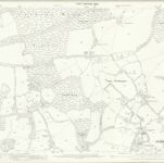
Berkshire XLIII - OS Six-Inch Map
1873|Ordnance Survey
1:10 560
Berkshire XLII - OS Six-Inch Map
1873|Ordnance Survey
1:10 560
Berkshire XLIV - OS Six-Inch Map
1873|Ordnance Survey
1:10 560
Berkshire XXXVI.13 (includes: Beenham; Bucklebury; Midgham; Woolhampton) - 25 Inch Map
1874|Ordnance Survey
1:2 500
12. Basingstoke.
1863|Great Britain. Board of Ordnance
1:63 360
Berkshire XLI - OS Six-Inch Map
1873|Ordnance Survey
1:10 560
England and Wales Founded Upon the Grand Trigonometrical Survey
1864|J. & C. Walker
1:557 982
1600
1650
1700
1750
1800
1850
1900
1950
2000
History
Old maps of West Berkshire
Discover the past of West Berkshire on historical maps
Old maps of West Berkshire
Discover the past of West Berkshire on historical maps
Explore Maps
Discover History
Parent places
England
Related places
© MapTiler
© OpenStreetMap