Project
Community
News
My App
My maps
Oxfordshire XXII.1 (includes: Lower Heyford; Rousham; Steeple Aston; Steeple Barton) - 25 Inch Map
1919
Ordnance Survey
1:3k
Oxfordshire XXII.1 (includes: Lower Heyford; Rousham; Steeple Aston; Steeple Barton) - 25 Inch Map
1875
Ordnance Survey
1:3k
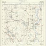
Oxfordshire XXII.NW - OS Six-Inch Map
1919
Ordnance Survey
1:11k
Oxfordshire XXII.NW - OS Six-Inch Map
1898
Ordnance Survey
1:11k
Oxfordshire XXII.5 (includes: Rousham; Steeple Barton; Tackley; Wootton) - 25 Inch Map
1919
Ordnance Survey
1:3k
Oxfordshire XXII.5 (includes: Rousham; Steeple Barton; Tackley; Wootton) - 25 Inch Map
1875
Ordnance Survey
1:3k
Oxfordshire XXII - OS Six-Inch Map
1919
Ordnance Survey
1:11k
Oxfordshire XXII - OS Six-Inch Map
1875
Ordnance Survey
1:11k
SP42 - OS 1:25,000 Provisional Series Map
1949
Ordnance Survey
1:25k
Oxfordshire XXII.2 (includes: Lower Heyford; Rousham; Steeple Aston; Upper Heyford) - 25 Inch Map
1875
Ordnance Survey
1:3k
History
Old maps of Rousham
Discover the past of Rousham on historical maps
Old maps of Rousham
Discover the past of Rousham on historical maps
Explore Maps
Discover History
Parent places
Oxfordshire
Related places